
YEP, THIS IS WHAT HAPPENS SHOULD YOU DECIDE TO DRIVE DOWN THE DEMPSTER HIGHWAY NEAR DAWSON
http://www.peelriverinn.com/dempster-highway.htm
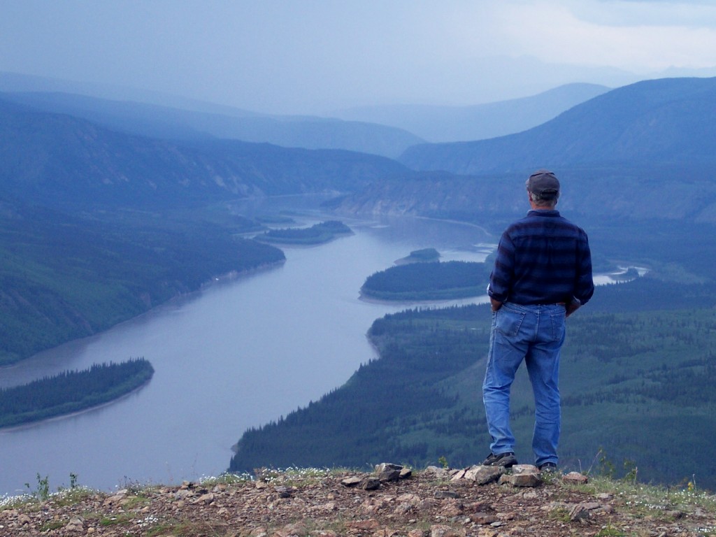
We were told, by several travelers who had recently taken the trip, that it is a must see. It was described to us as similar to the Swiss Alps views. Never having seen the Alps, we decided to take a chance. This is actually a 460 mile route to Inuvik. It is the only road so you must take the same road on the return trip. You cross the continental divide, and Arctic Circle. We drove about 80 miles up the highway taking us about 3 hours one way.
We did see some great vistas, stopped for picnic lunch and were happy to return. Can't really say we would recommend it for everyone.

A bit of a cloudy day but made the views very interesting.


This is part of what added to the truck mess. The entire 80 miles was pretty much a mess. We averaged between 30 and 40 MPH
We stayed Saturday night at a government campground near Stewart Crossing.


But did have lovely flowers right out side the camper door. The sites were huge and spaced far apart from each other so lots of privacy.
Took a long hike down to Moose Creek and Stewart River. Through lots and lots of woods. Don't know what we were thinking. This is the sign posted at the entrance to the trail.


Part way down the trail we came upon this stairs. Not sure how many steps, but lots. We took a different trail on the return trip, without a stairs, so it was a steep climb up a hill.


this is where the skeeters got us.
Took a short drive out of Dawson to the Dredge No 4.

Chatting outside the dredge after the tour.
We really didn't know what to expect but man did we learn a lot. Explained the piles and piles and piles of rocks for miles in and out of town. Found out they are called tailings, left from the large company mining with dredges. What a mess, too bad they weren't made to clean it up. Oh well.

Carl on tour of old dredge. The place was huge inside with lots of and lots of machinery.
We spent well over an hour on the tour and learned how these machines worked and how much gold they got, and how many workers they employed. Economic life line for the area at the time. Mining continues in the area. Below is a map of active claims being mined.


Stopped at "claim 33" where we found yet more history of the area. We could have paid a fee and done a little gold panning for ourselves, but chose just to walk around and take it all in.
Following are more photos from sites around "claim 33'


Dawson maintains it's old feel with dirt streets and wooden sidewalks.

Not only the main shopping district but the entire town has dirt streets and wood sidewalks. We figure it must be an ordinance. Very interesting.

Historical society provides walking history tours of the town with costumed guides. We didn't pay for one of these, but find them all over town. We did our own waking tour as many building have plaques attached telling of the history of that building. Again, very interesting. The gold rush days really only last two years before the big mining companies came in and took over. That is when the building really began. Prior to that it was a lot of tent building and rustic living. Once it became a "company town" amenities picked up.

Several buildings in obvious stages of disrepair around town with plaques telling of the problems with permafrost and foots. The historical society has been working for years at restoring them. Monumental tasks I am sure. This town is sure worth spending some time at. So much history giving a real feeling of the way it was in 1898.


We went there twice, at different times to take in the view. Never did make it up there for sun setting/rising as the sun set at 12:45 and rose at 2:30 while we were here. A little out of my time range.
No comments:
Post a Comment